
Our final day driving Route 66 in Arizona!
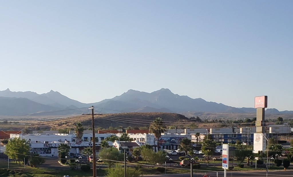
We awoke to the sun rising over the Hualapai Peaks to the east. We wouldn’t be passing through this mountain range; Route 66 skirts around the Hualapais. Instead, after coffee and a quick breakfast we crossed under Interstate 40, made a left turn and passed by homes and ranchettes as civilization faded away along a long, straight stretch toward the mountains.

About 20 miles across the sandy plain, we came upon Cool Springs. In the 1920s it offered gas and cool water to motorists making their way to the Pacific Ocean. It burned to the ground in 1966 (hmm … ‘66 … an odd coincidence), and was rebuilt using old photos just after the turn of the century. Now it’s a gift shop and museum. We passed by early enough that it hadn’t opened yet.

Our goal for the day was to spend a little time in the ridiculously cheesy town of Oatman. First, we had to navigate switchbacks, steep drop offs and burros in the roadway as we climbed towards Sitgreaves Pass.
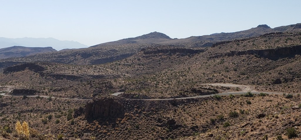
There are historical accounts of motorists being so nervous about this stretch of roadway (the steepest climb on the entire length of Route 66!) that they hired locals to drive their cars over the pass or simply had them towed. With our little two-seater, we whizzed along, stopping to snap a few shots of the scenery since there was no one behind us.
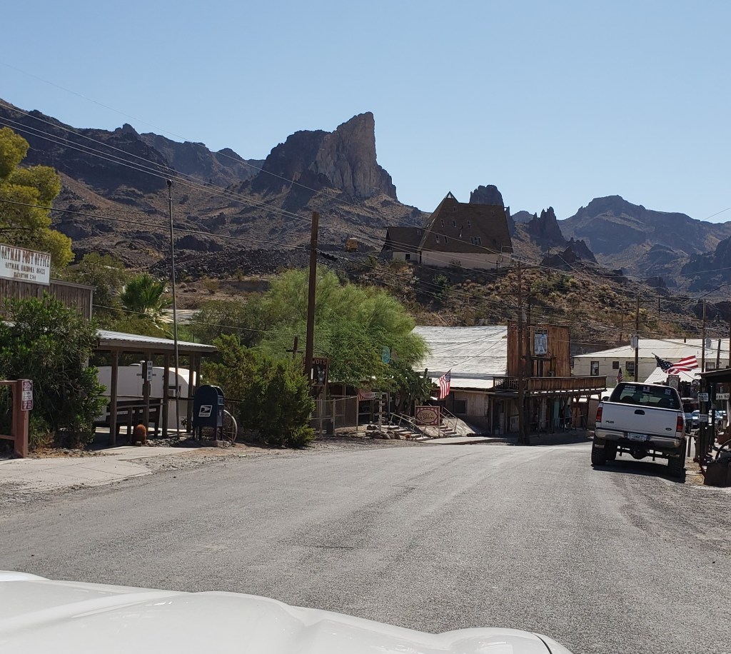
Over the pass, we came to Oatman. A once bustling mining town, it is now a tourist trap of epic proportions. WHAT FUN! There are times when you know you will encounter tourist crowds, over-priced “made in China” souvenir shops and scenes that are clearly recreated for effect. When you know what to expect, you can laugh and enjoy it … and you should.
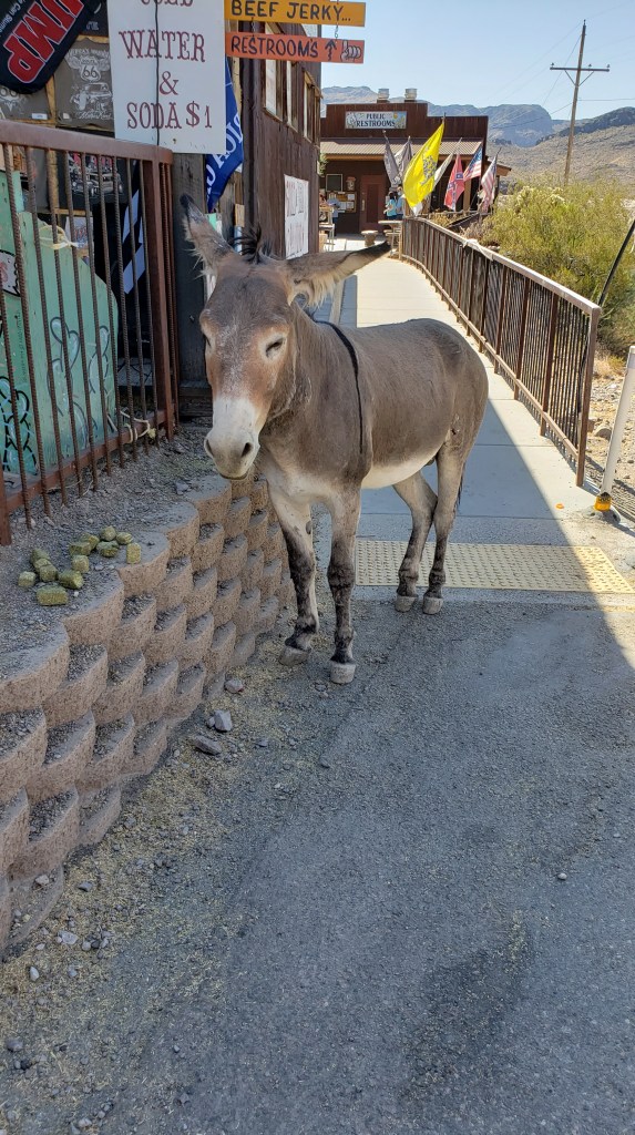
When Oatman was an active mine town, miners used burros to move their finds. When the miners left, they abandoned the burros. Now the descendants of those original burros are semi-wild and wander the streets enjoying the oatcakes sold as burro food from souvenir shops.

We arrived before the bulk of the crowds on a warm Sunday morning so we were able to enjoy the covered boardwalks and souvenir shops without jostling among tourists. We popped into the shops, snagged a souvenir Christmas ornament and Greg spotted an adorable pair of cowboy boots that will soon find their way to the feet of one of our granddaughters.

It was nearly lunchtime and we figured Oatman’s saloon would be the perfect place for a last meal along the historic road.

The road west and down the mountain doesn’t feature the hairpin turns and steep drops of the climb. Here, the land is scraped bare and creosote-dotted; the descent leads to a flattened expanse of sand before passing by a backwater channel of the Havasu National Wildlife Refuge.

You cross under a railroad bridge and this stretch of the original roadway ends, forcing you back onto the Interstate to cross the Colorado River and enter California. The original bridge, off to the left carries a pipeline rather than cars now.
Looking back, we’d seen four days worth of history. We’d visited places time tried hard to forget, but explorers and adventurers of today keep alive. We meandered our way across The Grand Canyon State at what many would call a snail’s pace. If you take I40, you can pass through the 359 miles in a day with ease. But if you opt to let those drivers pass you by, you will find adventures and sights that lodge in your memory and remind you to take a deep breath, relax and enjoy the journey.
There’s a whole world out there waiting to be explored. Take the road less traveled once in a while.
Catch up on the four day Arizona Route 66 Adventure: Day One the Arizona state line to Winslow, Day Two Winslow to Williams, and Day Three Williams to Kingman.
© The World A to Z, LLC 2020 — Unless otherwise indicated, no compensation was received for this blog.

I truly appreciate your technique of writing a blog. I added it to my bookmark site list and will
LikeLike